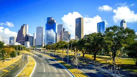

In a city defined by water, the Willow Waterhole Greenway has become one of Houston’s most effective answers to flooding.

Tucked between neighborhoods of Westbury and Meyerland, the nearly 300-acre complex was built first and foremost to slow, store, and safely release stormwater that would otherwise pour into the Brays Bayou watershed and into nearby streets and homes. In the process, a once-overlooked corner of Southwest Houston gained prairies, trails, and a shared space built atop serious engineering.
“The Willow Waterhole is a true jewel of Southwest Houston,” said Martha Castex-Tatum, Houston Mayor Pro Tem and District K council member. “The space is a detention facility. Water is being held at the Willow Waterhole before it disperses into our waterway systems. It’s extremely beneficial in the Westbury and Brazos area, as this area has flooded repeatedly. It has really been extremely effective in keeping water out of people’s homes and businesses.”
A model for dual-purpose infrastructure
What makes Willow Waterhole notable is not only its capacity but how that capacity is integrated into daily life. The basins are “wet-bottom,” meaning they hold water year-round at the same elevation as the bayou.
Excavated deep enough to sustain aquatic life, they attract birds, fish, and other wildlife. Moreover, restored tallgrass prairies and “no-mow” shelves stabilize banks and increase habitat while reducing erosion.
That dual mission was intentional from the start.
“You can’t go to this beautiful green space and not see signage explaining the detention piece,” said Howard Sacks, Levitt Pavilion Houston Board Chair and past President and advisory board member of Willow Waterhole. “The first goal of the Willow Waterhole project was to reduce the risk of flooding. And magically, along with that came this 300-acre public green space.”
The transformation did not happen overnight. It took years of advocacy, community building, and a $12 million fundraising campaign to bring the vision to life.
“There is groundwork that takes a long time to build relationships,” Sacks said. “Then the doors begin to open and foundations and public entities start to understand and believe in the vision and want to be a part of it.”
That belief has led to miles of concrete trails, a new fishing pier, and soon, a 15-acre Gulf Coast native prairie and educational boardwalk, an ecological classroom in the heart of the city.
A flood project, by design
The Harris County Flood Control District (HCFCD) began acquiring land in the early 2000s after decades of neighborhood advocacy and planning.
Construction on the six-basin, interconnected detention complex started in 2003. The final basins were finished in 2019.
The system can now hold up to 608 million gallons of stormwater before slowly releasing it back to Brays Bayou once peak flows subside.

Willow Waterhole works passively. During heavy rain, control structures in Willow Waterhole Bayou slow the flow and raise water levels just enough to send stormwater over concrete weirs into two “front-door” compartments (Scout and Heron lakes).
From there, large culverts connect all six basins so the entire system fills evenly. Flap gates prevent backflow until the bayou recedes, then the basins drain gradually, reducing the height and speed of floodwaters downstream.
The engineering is precise enough to be read in real time. At HCFCD’s Landsdowne Drive stream gauge, possible street flooding begins at about 51.2 feet of stream elevation, while likely structure flooding is estimated around 54.2 feet.
During a May 2021 storm, for example, the bayou peaked near 51.5 feet overnight before falling steadily through the next day.
Proof in the storms

The most compelling evidence came soon after the system went live. In late September 2019, less than a year after full connectivity, HCFCD reported “no structural flooding on Landsdowne Drive in Westbury along the Willow Waterhole Bayou,” even though 2.08 inches of rain fell in a single hour and the bayou rose 8.93 feet in just over two hours.
The new weirs shunted an estimated 200-300 acre-feet of water into the basins, creating a 7.62-foot difference in water surface elevation between upstream and downstream segments and relieving pressure across the watershed. Neighborhoods that had flooded repeatedly before the lakes were finished saw minimal flooding after completion.
Part of the bigger Brays picture
Willow Waterhole is one of four major detention sites in Project Brays, the decades-long federal-county partnership that has widened and deepened 21 miles of bayou, modified 30-plus bridges, and added 900 acres of detention capacity across the watershed. Together, these projects move 30% more water through Brays Bayou than before, critical in a region where tropical storms and slow-moving fronts can dump double-digit inches in a day.
In that broader context, Willow Waterhole is a template: Detention that is big enough to matter hydrologically, connected enough to work as one system, and inviting enough to knit a neighborhood together around it.
Looking ahead

Houston’s long, flat topography, clay soils, and rapid growth will continue to test drainage systems, especially as extreme rainfall becomes more frequent.
The overflow weirs (a low dam built across a river to raise the level of water upstream or regulate its flow) at Willow Waterhole are designed for about 13 inches in 24 hours. Any more rain than that, such as during Hurricane Harvey in 2017, will cause the bayou water to flood the surrounding neighborhoods.
But the track record since completion is clear: fewer flooded homes where flooding once felt inevitable and more time to respond when the water rises.
Side-bar: How it helps people where they live
For residents, the benefits show up in everyday ways:
- Lower flood risk for nearby homes and streets: By detaining hundreds of millions of gallons during peak rainfall, the basins reduce the height and speed of floodwaves that historically overtopped banks and pushed water into Westbury and Willow Meadows.
- Safer, clearer downstream channels: When basins “hold back” water, they give downstream storm sewers and bayous time to catch up, reducing back-ups that compound street flooding.
- Transparency and alerts. HCFCD’s Flood Warning System updates rain and stream levels every few minutes across 177 gauge stations. Residents can monitor Gauge 445 on Landsdowne Drive and set text or email alerts tied to those 51.2- and 54.2-foot thresholds, actionable information that can mean the difference between moving a car in time or not.
- Stronger soils and greener banks: Native plantings and prairie shelves slow runoff, filter sediment, and reduce the erosive energy that can undermine channel walls and trails. The 15-acre Native Prairie Conservation Reserve and a forthcoming educational boardwalk will double as living infrastructure and an outdoor classroom.
- Access that builds stewardship. Miles of ADA-compliant trails, safe crossings, wayfinding, and new parking make the basins visible and walkable.
MusicFEST 2025


On Oct. 25, the yearly tradition of MusicFEST will help bring attention to Willow Waterhole’s flood resiliency.
“In the beginning, the MusicFEST was just that…to get people out there,” said Margaret Greene, Levitt Pavilion board treasurer and MusicFEST chair, who moved to the area in 1965. “Flooding in that area has been devastating. To have a MusicFEST out there that brought people to the park and they can see it, it took a little while for a lot of people to even know it was there and where their flood mitigation dollars were going.”
In addition to live music, the festival will also feature food, art cars, and Halloween-themed attractions, including a haunted house, trunk-or-treat, and a costume parade — all in a picturesque urban greenspace. https://t.co/4MKz4bhEzj
— Brays Oaks (@BraysOaksMD) October 14, 2025
- When: Saturday, October 25, 2025, 11 a.m. – 8 p.m.
- Where: Willow Waterhole Greenway (5300 Dryad Drive, Houston, TX 77035)
- Headliner: Skyrocket (6 – 8 p.m.)
- Early sets: Westbury Feeder School Bands, Jazz Houston Orchestra, Woody Witt, Klockwork, and Charlie y la Tribu Cubana
- Extras: Halloween costume parade, food trucks, games, and family activities, VIP Area
Admission: Free.